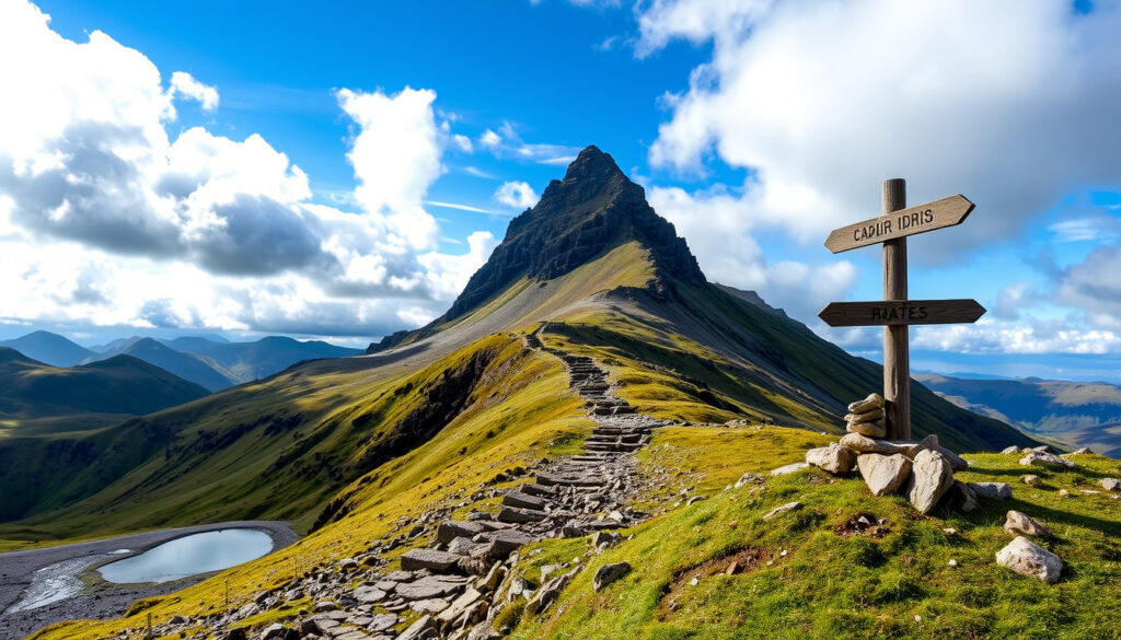
Cadair Idris – Complete Hiking Guide with Routes and Safety Tips
Cadair Idris rises to 893 metres at the southern edge of Eryri (Snowdonia) National Park, drawing hikers with a reputation that sometimes feels larger than the mountain itself. While not among the tallest peaks in Wales, its combination of steep, uneven terrain, sudden weather shifts, and deep-rooted folklore makes it a memorable and serious undertaking for anyone who sets out to reach its summit.
The mountain is often described as a harder challenge than its raw height suggests. Its paths cross boggy ground, loose scree, and exposed ridgelines where navigation can become difficult in low cloud. Understanding the routes, conditions, and practical logistics matters before heading up.
How High is Cadair Idris? (Height, Location & Key Facts)
Moderate mountain; 3-5 hr climb
Easiest, well-defined pathway
Requires fitness; stream crossings, boggy sections
Free/paid lots; limited on peak days
- Cadair Idris reaches 893m (2,930 ft), located in Meirionnydd, Gwynedd, at the southern edge of Eryri National Park. (Wikipedia / threepeakschallenge.uk)
- The Pony Path is the most beginner-friendly route, while the Fox’s Path offers a steeper, looser ascent. (Visit Wales)
- Weather can change rapidly; mist and high winds are common even in summer. The summit is fully exposed. (Natural Resources Wales / Wikipedia)
- The mountain contains a National Nature Reserve, designated for its rare arctic-alpine plants and dramatic glacial landscape. (Natural Resources Wales)
| Metric | Value |
|---|---|
| Height | 893m / 2,930 ft |
| Location | Meirionnydd, Gwynedd, Wales (Snowdonia south) |
| Best time to climb | May–September (longer daylight, milder) |
| Quickest route duration | Pony Path: 3–4 hrs round trip |
| Circular route duration | Minffordd Path: 5–6 hrs via Llyn Cau |
| Bothy available? | Yes: Llyn Cau Bothy (unlocked, basic) |
| Danger rating | Moderate (exposed summit, rapid weather change) |
Which Route is Best? (Pony Path, Fox’s Path & Circular Walks)
Pony Path
The Pony Path is widely described as the easiest and most gradual of the main routes. It starts from Ty Nant car park near Dolgellau and climbs via a well-defined track that zigzags up the northern side of the mountain. There is no scrambling except for a short rocky section near the summit. The return distance is about 9–10 km, with roughly 700–727 m of ascent, and most walkers allow 5–6 hours. Eryri National Park classifies it as a hard/strenuous walk suitable for experienced walkers with good fitness and navigation skills. (walksnowdonia.co.uk, eryri.gov.wales, komoot.com)
Minffordd Path
Starting from the Cadair Idris / Dôl Idris car park off the A487, the Minffordd Path is a steeper alternative. It climbs past Llyn Cau, the dramatic glacial lake, before a short scramble near the summit. Route guides rate it as hard, with a round trip of about 10 km and roughly 964 m of ascent. Typical times range from 4 to 6 hours depending on conditions and pace. (thegreatoutdoorsmag.com, beckythetraveller.com)
Fox’s Path
The most direct route is also the least forgiving. The Fox’s Path ascends a steep, loose scree gully on the north-east face. Multiple sources describe it as risky and not recommended for standard walking unless conditions are ideal and the walker is experienced. It is sometimes used as an adventurous descent from the summit in combination with the Pony Path, but this is not the standard approach. (walksnowdonia.co.uk, walkscene.co.uk, walkingbritain.co.uk)
Route guides consistently recommend the Pony Path for those new to Cadair Idris, but they also stress that this is a serious mountain walk, not a casual hike. Good navigation skills matter, especially in mist or low cloud, because the upper sections become exposed and pathfinding becomes much harder. (walksnowdonia.co.uk, komoot.com, eryri.gov.wales)
Is Cadair Idris Dangerous? (Difficulty, Weather & Safety Guide)
The question is reasonable. Cadair Idris is not technically a climb, but its conditions can turn hazardous quickly. The main dangers are exposure, rapid weather change, and difficult ground underfoot.
Weather and visibility
Multiple guides note that mist or low cloud is a specific danger. The mountain sits high enough to generate its own microclimate, and walkers can experience clear skies at the base while the summit is shrouded in cloud with near-zero visibility. (walkscene.co.uk, thebaldscrambler.co.uk)
Terrain and difficulty
Even the easiest route, the Pony Path, is classified as hard/strenuous by Eryri National Park. Stream crossings, boggy sections, and uneven surfaces require proper footwear. The Fox’s Path introduces loose scree that can cause slips if care is not taken. (eryri.gov.wales)
Gear and preparation
Proper boots and adequate clothing are advised, even in summer. A waterproof jacket, warm layer, map, compass, and charged phone should be considered minimum equipment. The Met Office mountain weather forecast is a practical pre-trip check. (walkscene.co.uk, metoffice.gov.uk)
Several guides point out that pathfinding becomes significantly harder when visibility drops. The upper sections of the mountain are exposed, and without a clear view of the route, walkers can easily lose their bearings. An offline Ordnance Survey map (OL23) is a wise addition to any pack. (thebaldscrambler.co.uk, eryri.gov.wales)
Where to Stay & How to Get There (Directions, Parking & Accommodation)
Parking for Cadair Idris
The main starting point for the Pony Path is Ty Nant car park, reached by heading toward Dolgellau and following the road to the car park. The Minffordd route starts from the Cadair Idris / Dôl Idris car park off the A487. Parking can fill up by 9 am on sunny weekends, and arriving early is strongly recommended. (walkscene.co.uk, thegreatoutdoorsmag.com, beckythetraveller.com)
Accommodation near Cadair Idris
The nearest town for accommodation is Dolgellau, which offers a range of B&Bs, guesthouses, and campgrounds. For those seeking a more unusual stay, there is a small bothy near the summit, described as the remains of an old tea house. It sits on the Pony Path/Minffordd side and provides basic, unlocked shelter with no booking required. (thegreatoutdoorsmag.com)
How long does it take?
The Pony Path round trip typically takes 3–4 hours for a reasonably fit walker moving at a steady pace, though most guides suggest allowing 5–6 hours. The Minffordd Path takes 4–6 hours. The full traverse of the mountain, which is an end-to-end walk not a loop, covers about 18.6 km and takes 8–9 hours. (thegreatoutdoorsmag.com, livefortheoutdoors.com, mudandroutes.com)
What is the Cadair Idris Timeline for a Typical Climb?
- Pre-Climb (30 mins): Park, check weather, pack gear, finalise route at Minffordd/Dolgellau.
- Ascent: Pony Path (1.5–2 hrs): Steady gradient from Dolgellau side past waterfalls, boggy near top.
- Summit / Penygadair (30 mins): Panoramic views, trig point, sheltered dip for lunch. Windy.
- Descent via Fox’s Path or same route (1.5–2 hrs): Steep scree if using Fox’s Path; careful foot placement required.
- Post-climb (15 mins): Return to car, log mountain safety with friend/family.
What is Certain and What Remains Uncertain About Cadair Idris?
| Established information | Information that remains unclear |
|---|---|
| Cadair Idris is 893 m high, confirmed by Ordnance Survey data. | Weather stability in summer is uncertain; mountain microclimate can drop visibility suddenly. |
| The Pony Path is the easiest route, confirmed across multiple sources, though eroded in places. | Parking at Minffordd is always available? Uncertain; fills by 9 am on sunny weekends. |
| Llyn Cau is the lake featured in legend; says whoever sleeps on the mountain will wake a poet or madman. | Trail conditions can change week to week due to weather and footfall. |
Why is Cadair Idris Considered Harder than Snowdon?
While Snowdon is taller, Cadair Idris features less maintained paths, frequent boggy sections, and fewer escape routes. The steeper sections on the Fox’s Path require scrambling, and the overall terrain quality makes it a more physically draining climb per metre of ascent. Many walkers report feeling the effort more acutely here than on Snowdon’s well-groomed tourist paths. (Wikipedia)
The legend of the Chair of Idris adds cultural weight. Cadair Idris translates to “Chair of Idris,” referencing a giant or poet from Welsh mythology who is said to have used the summit as his throne. Folklore holds that anyone spending the night alone on the summit will wake either a poet or a madman. That story, combined with the mountain’s isolated feel, gives it a distinct character. (Wikipedia)
Sources and Credibility: What Do Official Guides Say?
“The Pony Path is a well-defined track that zig zags up the northern side of the mountain, making it the easiest route.”
– Visit Wales (Cadair Idris Walking Guide)
“Cadair Idris National Nature Reserve is made up of a range of mountains in the south of Eryri National Park.”
– Natural Resources Wales (Cadair Idris NNR)
The Wikipedia entry on Cadair Idris provides a comprehensive factual profile, while the official Snowdonia National Park site offers broader context on the surrounding area. For those planning a visit, the Met Office Mountain Weather Forecast and the Ordnance Survey OL23 map are practical tools.
Summary: Should You Climb Cadair Idris?
Cadair Idris is a serious mountain walk that rewards preparation and respect. It offers a genuine sense of remoteness and challenge within reach of a day trip from much of Wales and northern England. Those who enjoy the outdoor content of guides like Polar Bear – Complete Guide to Size, Diet and Conservation or the cultural curiosity of Barbara Hepworth – Life, Death, and the Museum in St Ives may find the blend of nature and folklore here equally compelling.
FAQs about Climbing Cadair Idris
Is Cadair Idris harder than Snowdon?
Not taller, but many find it more arduous underfoot due to boggy terrain and steeper descents on the Fox’s Path.
What is the lake on top of Cadair Idris called?
Llyn Cau, a glacial lake set in a dramatic cwm near the summit.
Does Cadair Idris have a bothy?
Yes. Llyn Cau Bothy sits near the lake, basic shelter, no booking required.
Is Cadair Idris part of Snowdonia?
Yes. It lies in the southern section of the Eryri (Snowdonia) National Park.
What does Cadair Idris mean?
‘Chair of Idris’ in Welsh, referencing the giant Idris Gawr.
What is the Pony Path route like?
It is a steady, well-defined track on the northern side, considered the easiest main route but still a strenuous mountain walk.
Where do I park for the Pony Path?
Ty Nant car park, reached by heading toward Dolgellau. Arrive early, as it fills quickly on fair-weather weekends.
What is the best time of year to climb Cadair Idris?
May to September offers longer daylight and milder conditions, though weather remains unpredictable year-round.
Can I climb Cadair Idris alone?
Yes, but it is recommended to inform someone of your route and expected return time, carry a map and compass, and check the weather forecast.
Is there a circular walk on Cadair Idris?
A common circular combines the Pony Path and Fox’s Path, starting and ending at Ty Nant car park.
More related posts
 Nick Mason – Pink Floyd’s Drummer and Legendary Car Collector
 How Many Square Feet in an Acre – Exact Dimensions and Facts
 James Van Der Beek – Cause of Death, Family and Career
 Karen Henthorn – Biography, EastEnders Role and Return Rumors
 Robert Rinder – Biography, Career, and TV Judge
 Venom The Last Dance – Release Date Cast Villain Box Office
 Anwar Hadid – A Complete Guide to His Life and Career
 Trey Parker – Net Worth, Wife, Movies and Biography
